InTDS ArchivebyMy Data TalkFolium Map: How to Create a Table-Style Pop-up with HTML CodeA Step-by-Step Guide to Level-up Your Folium Skills for Geospatial Data VisualizationDec 16, 2021Dec 16, 2021
InRotten GrapesbyKrishna G. LodhaDownload Sentinel Data within seconds in pythonCheckout this blog to understand how we can use stac specification and it’s implementation in python to get Sentinel data quicklyFeb 6, 20241Feb 6, 20241
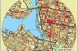
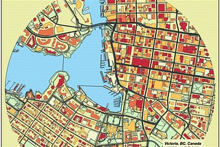
InLevel Up CodingbyJohn Loewen, PhDPretty Maps: A Surprisingly Useful Way To Better Your Streamlit SkillsA Python streamlit tutorial on creating beautiful maps with the prettymapp libraryMay 16, 20242May 16, 20242
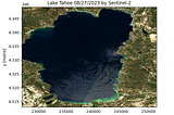
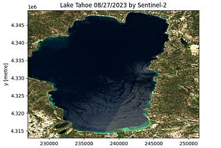
InTDS ArchivebyMahyar Aboutalebi, Ph.D. 🎓A Simple Way for Downloading Hundreds of Clipped Satellite Images Without Retrieving the Entire…Learn how to download a clipped Sentinel-2 image for any Area of Interest (AOI), Lake Tahoe here, with just 12 lines of script.Apr 26, 20242Apr 26, 20242
InPython in Plain EnglishbyEverton Gomede, PhDEarthPy: Simplifying Geospatial Data Analysis in PythonIntroductionJan 26, 20242Jan 26, 20242
Milan JanosovThe Geospatial Data Science Stack in 2023I just finished the #30DayMapChallenge, which was the perfect task to overview the tools I use the most as a geospatial data scientist.Dec 2, 20239Dec 2, 20239
InTDS ArchivebyEugenia AnelloGeospatial Data Analysis with GeoPandasLearn how to manipulate and visualize vector data with Python’s GeoPandasMay 6, 20234May 6, 20234
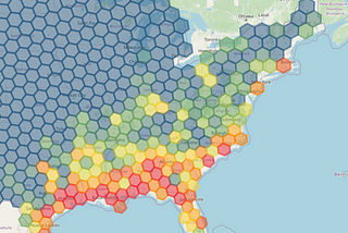
InPython in Plain EnglishbyDaniel van der MaasCreating beautiful Hexagon maps with PythonA popular way of visualising GIS data is by means of hexagons. With a group of hexagons you can cover a region of your choosing and style…Apr 3, 20234Apr 3, 20234
InSpatial Data SciencebyAbdishakurThe Best New Books To Study Geospatial Data ScienceRecent Books in Geospatial Data ScienceNov 23, 2022Nov 23, 2022
Maksym Kozlenko 🇺🇦OSMnx Part 1. Loading data from Open Street Maps and finding shortest route between two pointsOpen Street Map is a collaborative project to create a free editable geographic database of the world. It contains information about roads…Oct 16, 20213Oct 16, 20213
InNerd For TechbyEduardo VirtuosoTime-lapse heat maps with FoliumA tutorial for those interested in creating a heat map with time-lapse using Python.Mar 5, 20211Mar 5, 20211
InAppsilonbyDario RadečićHow to Connect Google Earth Engine with R ShinyWant to include Google Earth in your R Shiny apps? This article shows you how to connect Google Earth Engine with R Shiny.Jun 2, 2022Jun 2, 2022
InTDS ArchivebyAngelica Lo DucaHow to Perform Exploratory Data Analysis in QGisA tutorial on how to use QGis to perform EDA of geographical data which is provided as CSV.May 30, 2022May 30, 2022
InTDS ArchivebyGuilherme M. IablonovskiLooking for patterns in satellite image time series with pythonA quick guide for handling time-varying imagery with open python librariesMay 11, 20222May 11, 20222
InTDS ArchivebyAdithya KrishnanBuild a geospatial dashboard in Python using GreppoLack of frontend, backend and web-dev experience can be limiting in making a web-app in Python. Not anymore…Feb 23, 20226Feb 23, 20226
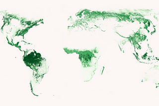
InTDS ArchivebyAndrew Joseph DaviesLand Cover Image Classification Using a TensorFlow CNN in PythonEuroSAT land cover image classification using a TensorFlow convolutional neural networkMar 15, 2022Mar 15, 2022
InTDS ArchivebyAndrew Joseph DaviesLand Cover Image Classification Using a TensorFlow CNN in PythonEuroSAT land cover image classification using a TensorFlow convolutional neural networkMar 15, 2022Mar 15, 2022
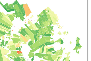
InTDS ArchivebyAdam SymingtonCreating Beautiful Forest Maps with PythonUse raster files to generate eye-catching visualisations with MatplotlibMar 3, 20221Mar 3, 20221
InTDS ArchivebyAdam SymingtonCreating Beautiful Forest Maps with PythonUse raster files to generate eye-catching visualisations with MatplotlibMar 3, 20221Mar 3, 20221
InTDS ArchivebyAdam SymingtonCreating Beautiful Forest Maps with PythonUse raster files to generate eye-catching visualisations with MatplotlibMar 3, 20221Mar 3, 20221